The temple and its moat
Cross the moat, go through the western gate and follow the stone road to the temple. Its three levels, galleries and five towers are modelled by hand on the measurements in OpenStreetMap.
 Instant Cities
Walk or race over the causeway, past the moat and the towers of Angkor Wat.
The moat, the long causeway and the gate at its end, and the temple itself: three levels of galleries rising to five towers.
Free · no account · works on PC, tablet and phone
Cross the moat, go through the western gate and follow the stone road to the temple. Its three levels, galleries and five towers are modelled by hand on the measurements in OpenStreetMap.
From the far side of the moat through the gate and up to the temple, then along its north side to the east, once, from a start gate to a finish gate.
The moat, the paths, the ponds and the outer enclosure come from OpenStreetMap.
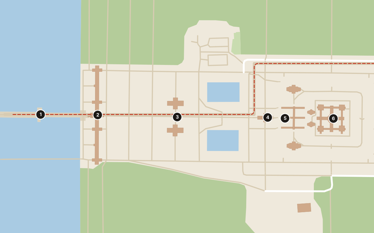
A moat 190 metres wide runs right round the temple, 5.5 kilometres in all. It stands for the ocean round Mount Meru, home of the gods, and it kept the temple’s ground damp and firm.
The long gate in the outer wall, with three towers. Elephants could walk through the middle. Behind it a stone road runs 350 metres to the temple.
Two small buildings on either side of the road, called libraries. Nobody knows what they held: scrolls, or sacred objects.
A cross-shaped terrace in front of the temple, where the king is thought to have met the people. Carved nagas, seven-headed snakes, guard the road.
The outer gallery is 800 metres long and carved with scenes from Hindu epics and the king’s battles: the longest stone relief in the world. Two more galleries rise above it.
Built in the early 1100s for the Khmer king Suryavarman II, first as a Hindu temple and later a Buddhist one. Three levels rise to five towers, the middle one 65 metres high, in the shape of the mountain of the gods.
Still in development: expect some rough edges.